Marine Sites
-
Darss-Zingst Bodden
Darss-Zingst Bodden
REFERENCE PERSON: Hendrik Schubert (University of Rostock)COUNTRY: Germany BIOGEOGRAPHIC REGION: Continental MAIN ECOSYSTEM/HABITAT type (Eunis classification): Lagoon ALTITUDE (meters a.s.l.): 1 m SIZE (ha): 19.700 ha Date of establishment as LTER site: 2005 DESCRIPTION: The Darss-Zingster Bodden is a tideless flat brackish inner coastal water of the Southern Baltic Sea. It consists of 4 consecutive water basins connected by narrow streams. This forms a gradient of salinity from 1-14 PSU and a eutrophication gradient. The site is equipped with automatic recording systems for physical and chemical water parameters and run a dayli water chemistry sampling scheme for nutrients.Main research topics: food web analysis and biotic monitoring-Main LTER parameters: beside abiotic parameters, biotic inventory changes and changes in food web structure.Website: - 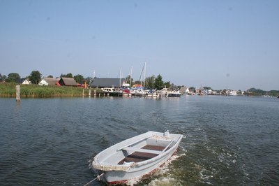
-
Gulf of Trieste
Gulf of Trieste
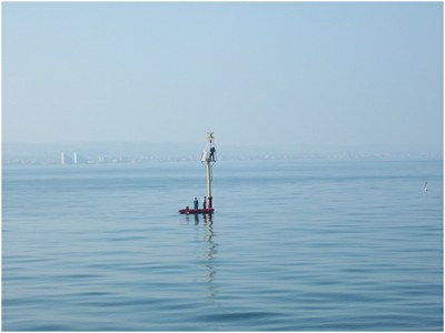
REFERENCE PERSON: Bruno Cataletto (OGS -Istituto Nazionale di Oceanografia e di Geofisica Sperimentale)COUNTRY: Italy BIOGEOGRAPHIC REGION: Mediterranean MAIN ECOSYSTEM/HABITAT type (Eunis classification): Marine and coastal habitat: it is a part of Natural Marine Reserve and Natural Protected Marine Areas ALTITUDE (meters a.s.l.): 0 m SIZE (ha): 0 ha Date of establishment as LTER site: 2006 DESCRIPTION: The Department of Biological Oceanography of the Italian National Institute of Oceanography and of Experimental Geophysics is responsible for the site Gulf of Trieste, part of macrosite North Adriatic inserted in the international network LTER (Long Term Ecological Research) that continues the historical series of hydrological, biological and biochemical data initiated by the University of Trieste in 1970. It is a shallow coastal station (17 m depth) located at 0.2 Km from the coast, at the outer border of the Natural Marine Reserve of Miramare. The research activities range from marine biogeochemistry to physiology, from ecology to traditional marine biology and are aimed to understanding the dynamics governing marine ecosystems in its complexity, and to evaluating the role of oceans in the global energy balance. The studies on local scale regard coastal and transition waters and address problems related to their sustainable management.Website: http://nettuno.ogs.trieste.it/ilter/BIO/ 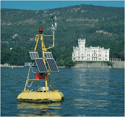
-
Gulf of Venezia and Trieste
Gulf of Venezia and Trieste
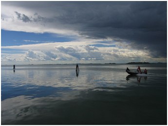
REFERENCE PERSON: Mauro Bastianini (National Research Council- Institute of Marine Sciences)COUNTRY: Italy BIOGEOGRAPHIC REGION: Mediterranean MAIN ECOSYSTEM/HABITAT type (Eunis classification): Marine habitats, Pelagic water columnALTITUDE (meters a.s.l.): 0 m SIZE (ha): 500 ha Date of establishment as LTER site: 2006 DESCRIPTION: The site is under a heavy antropic impact (nutrient loads, coastal towns, fishery, tourism maritime routes). In the past eutrophic events struck the ecosystem and, more recently, frequent mucus macro-aggregates extended in the whole basin.Meteo-oceanographic observations are available form the end of XIX century but at irregular scale. A century of regular meteorological observations is available for the last century. Biological observations were conducted since the ‘60’s with increasing regularity in the last decade.Metereological data have been collecting sonce the second half of XVIII century. Sea level since the end of XIX. Sea temperature has been measured since the beginning of XX century.Hydrological measurements with nutrient concentrations, particulate matter, Phyto and zooplankton abundance and diversity have been studied with some discontinuities from the ‘70 but on a regular monthly base from the ‘90’s.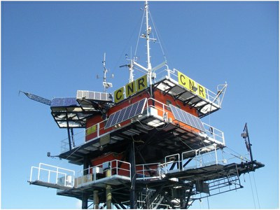
-
Lagoon of Venice
Lagoon of Venice
-
Marechiara
Marechiara
-
Po Delta and Romagna Coast
Po Delta and Romagna Coast
REFERENCE PERSON: Mariangela Ravaioli (National Research Council- Institute of Marine Sciences)COUNTRY: Italy BIOGEOGRAPHIC REGION: Mediterranean MAIN ECOSYSTEM/HABITAT type (Eunis classification): Marine habitats, Pelagic water columnALTITUDE (meters a.s.l.): 0 m SIZE (ha): 70000 ha Date of establishment as LTER site: 2006 DESCRIPTION: Marine coastal areas located in front of the Po river delta and Romagna coast are affected by wide euthropication and mucilaginous phenomena by decades so they are considered favourable environments for the development of ipo-anoxic events. For these reason two fixed buoys has been installed to monitor these phenomena. The S1 buoy (44.74 N, 12.46 E) is located SE of the delta of the Po di Goro in the influence area of the main stream of the Po river: this "shallow water" area has been intensively studied over the years, both in the sediment and in the water column, and is considered a key area for the study of interactions between the river Po and the Adriatic basin. The site is therefore ideal for studies of climate variability of the Adriatic, on the role of the seabed in the dystrophic local processes, the processes of sedimentation and resuspension of sediment in the area of prodelta. The E1 buoy (44.14 N, 12.57 E), located N of the Rimini coast is representative of the entire coastal area of the central Northern Adriatic sea and it is especially useful for the monitoring of hypo-anoxic episodes.Main research topics: Survey of environmental physico-chemical and hydrological variables, biogeochemicl cycles.Main LTER parameters: meteorology, temperature, salinity, dissolved oxygen, pH, current and waves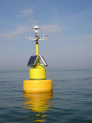
-
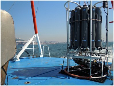
Senigallia-Susak transect
Senigallia-Susak transect
REFERENCE PERSON: Mauro Marini (National Research Council- Institute of Marine Sciences)COUNTRY: Italy BIOGEOGRAPHIC REGION: Mediterranean MAIN ECOSYSTEM/HABITAT type (Eunis classification): Marine habitats, Pelagic water columnALTITUDE (meters a.s.l.): 0 m SIZE (ha): 0 ha Date of establishment as LTER site: 2006 DESCRIPTION: The ISMAR-CNR of Ancona, in collaboration with University of Padua and with the Politechnical University of Marche collects from the end of years 80s physical, chemical and biological data of a transect located in the northern Adriatic: Transect of Senigallia. This is an excellent observing site to analyze the characteristics of water masses entering and leaving the North Adriatic Sea and their possible modifications. Hydrological and nutrient concentration were collected intermittently from 1988 to 1998, monthly from 1999 to 2002 and bimonthly thereafter until today. Data on phytoplankton communities (abundance, biomass and community structure) collected with a monthly frequency are available from 1988 to 2002 and from 2007 to present.